
Marine Mammal Ecology is the study of mammals, such as seals, whales and dolphins, and how they interact with the marine and coastal environment in which they live; it encompasses population dynamics, genetics, physiology, acoustics, foraging and reproductive behaviour.
MRI Whale Unit
Marine mammals have been studied at the Mammal Research Institute (MRI) since the 1970’s, when work on Antarctic and Sub-antarctic seals began. This work formed the basis for the establishment of several long-term research projects that persist to this day. The formation of the MRI Whale Unit consolidated cetacean research at the MRI in the 1980’s.
Established in 1985, the Mammal Research Institute (MRI) Whale Unit is a global, African research, conservation and education facility that researches the ecology, population dynamics and behaviour of the diverse cetaceans (whales, dolphins and porpoises) in the southern African sub-region and surrounding oceans, with the principal objective of providing knowledge that will promote their conservation.
A primary raison d’être of the Unit remains the development of human capacity in these areas. Research, Conservation and Education are interlinked to execute forward-looking programmes, integral for the understanding of conservation priorities for African cetaceans.
Satellite tagging of southern right whales
Since 2021, the MRI Whale Unit at the University of Pretoria has been deploying satellite tags on adult southern right whales to track their migration and feeding behaviour in unprecedented detail. This research is crucial, as the past decade has seen significant changes in southern right whale migration patterns, reproduction, and body condition, likely driven by reduced prey availability in the Southern Ocean due to climate change. Each tag can provide up to a year of continuous data, helping us understand how these whales are responding to a rapidly changing environment.
This research project is run in collaboration with the following people and organisations: Dr Alex Zerbini and Dr Amy Kennedy from the National Oceanic and Atmospheric Administration (NOAA), University of Washington’s Cooperative Institute for Climate, Ocean and Ecosystem Studies (CICOES/UW), and the Marine Ecology and Telemetry Research (MarEcoTel).
Funding for this work was provided by the National Oceanic and Atmospheric Administration (NOAA), the Marine Ecology and Telemetry Research (MarEcoTel), WWF Protecting Whales & Dolphins Initiative, a private donor (Marcel Weder), TotalEnergies, and the South African Polar Research Infrastructure, to whom we are very grateful.
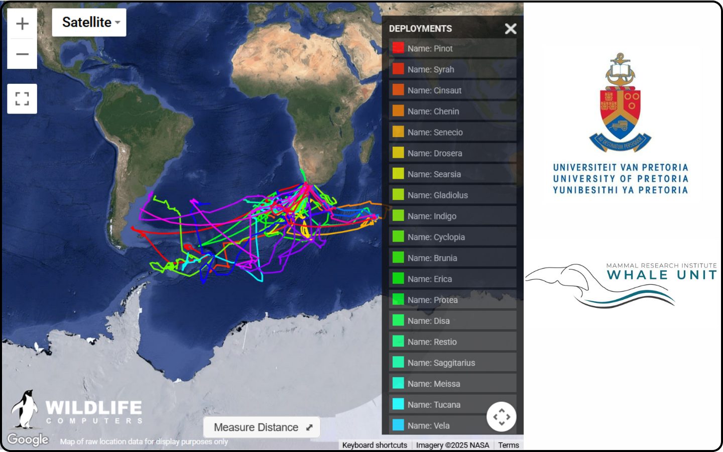
The map below shows the tracks of adult southern right whales that were tagged in Walker Bay in 2025*
*For live tracking of the satellite-tagged whales, visit the original article by the MRI Whale Unit.
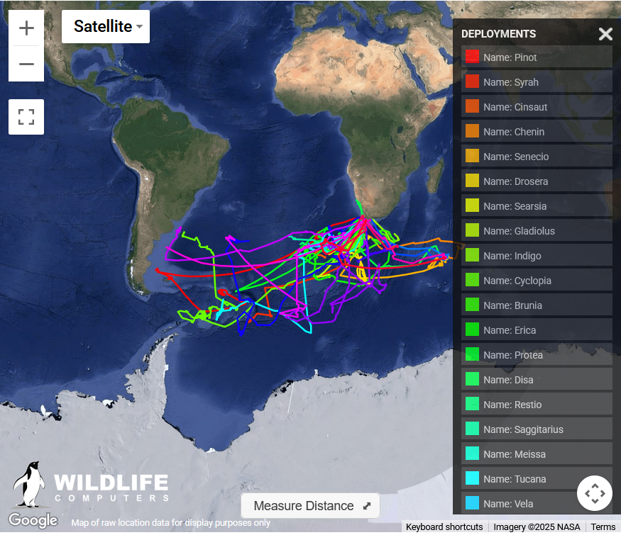
The map below shows the tracks of adult southern right whales that were tagged in Walker Bay in October 2021, 2022, 2023, and 2024*
Deployment of CTD tags, which provide us data on water temperature, salinity and depth at which the whale swims, runs in collaboration with Prof Mads-Peter Jorgenson from the Greenland Institute of Natural Resources, Prof Jonas Teilmann from Aarhus University, Dr Alexandre Zerbini from the National Oceanic and Atmospheric Administration (NOAA), University of Washington’s Cooperative Institute for Climate, Ocean and Ecosystem Studies (CICOES/UW), and the Marine Ecology and Telemetry Research (MarEcoTel) and Wildlife Computers. It is a project funded by the Office of Naval Research (ONR).
The map below shows the tracks of adult southern right whales, which were tagged with CTD tags in Walker Bay in October 2023 and 2024*
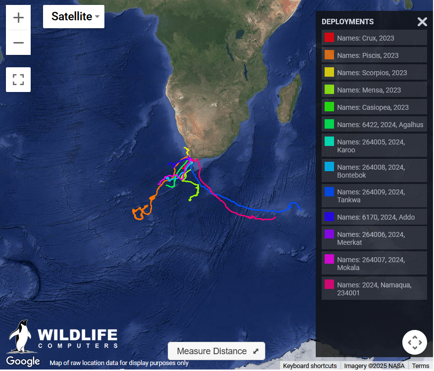
Satellite tagging of Humpback whales
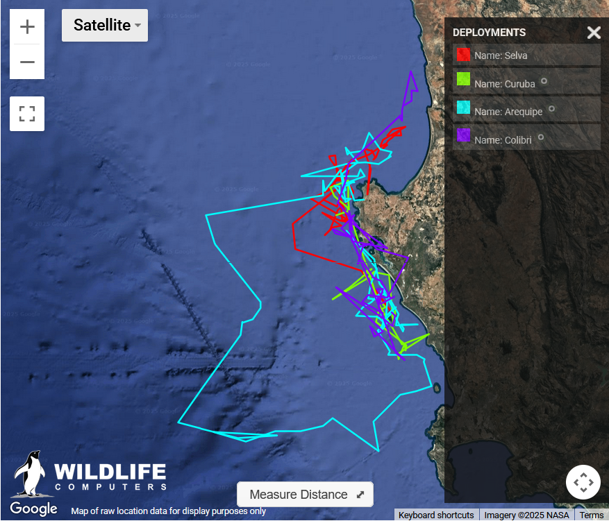
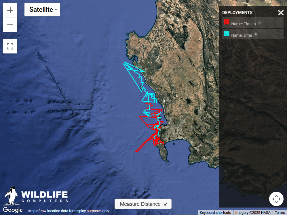
Since 2025, we have been deploying satellite tags on adult humpback whales to track their movement pattern and feeding behaviour along our west coast during the summer months. These tracks help us understand where humpback whales concentrate their foraging effort, how they move through dynamic coastal ecosystems, and which areas are most important for their survival. This information is also used in a wider project related to the effects of climate change on humpback whale populations.
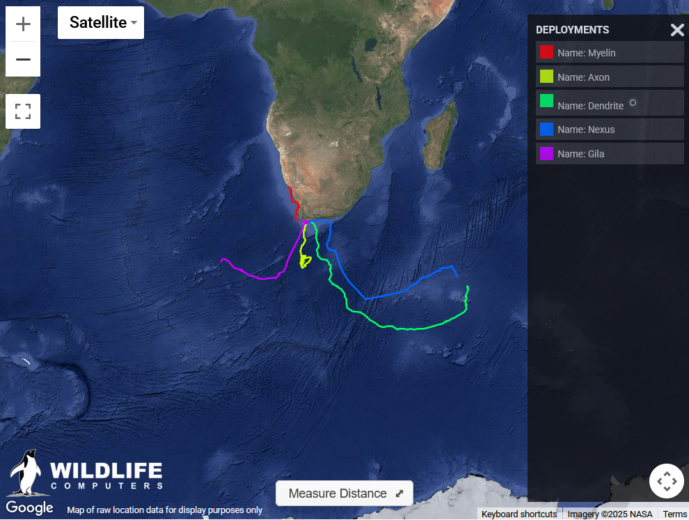
The two maps below show the tracks of 6 humpback whales tagged in Yzerfontein in November 2025*.
This project runs in close collaboration with Dr Alexandre Zerbini and is made possible through the generous support of the South African Polar Research Infrastructure and Whale Expedition, to whom we are very grateful.
The South African Polar Research Infrastructure supports long-term observations of South Africa’s marine and polar regions by providing access to research infrastructure such as animal satellite tags.
This article was originally published on the Mammal Research Institute (MRI) Whale Unit website authored by Dr Els Vermeulen and Chris Wilkinson (link).